Product Panel
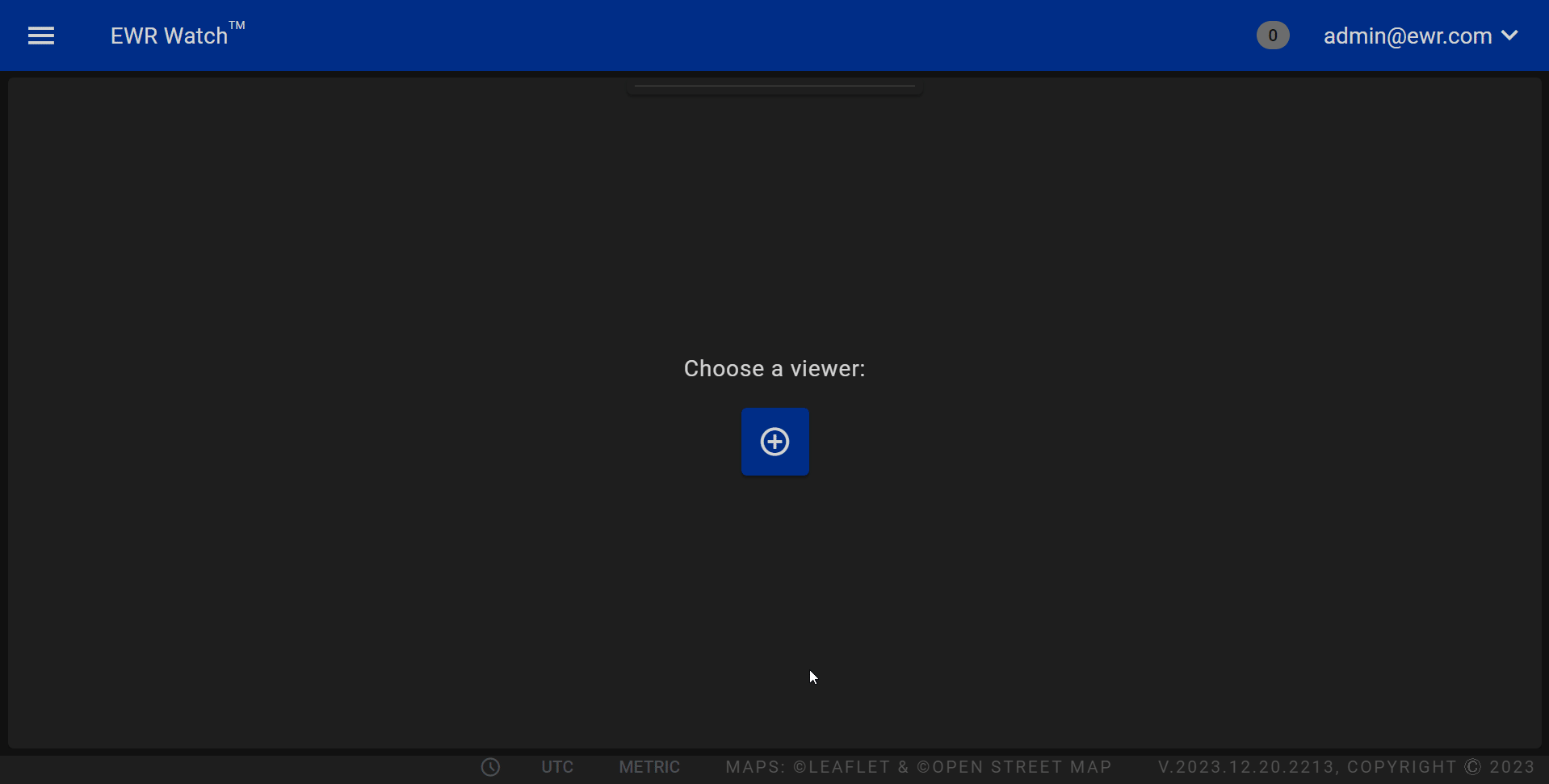
Welcome to our product panel, a comprehensive panel designed to empower users with dynamic insights into current and historic weather phenomena. This panel is divided into four key sections: a dynamic Map Area for displaying radar product data, an interactive Scrubber Bar featuring playback controls and a detailed timeline, and a versatile Product Panel Control Bar and a Panel Layout Menu offering precise customization options.
Map Area
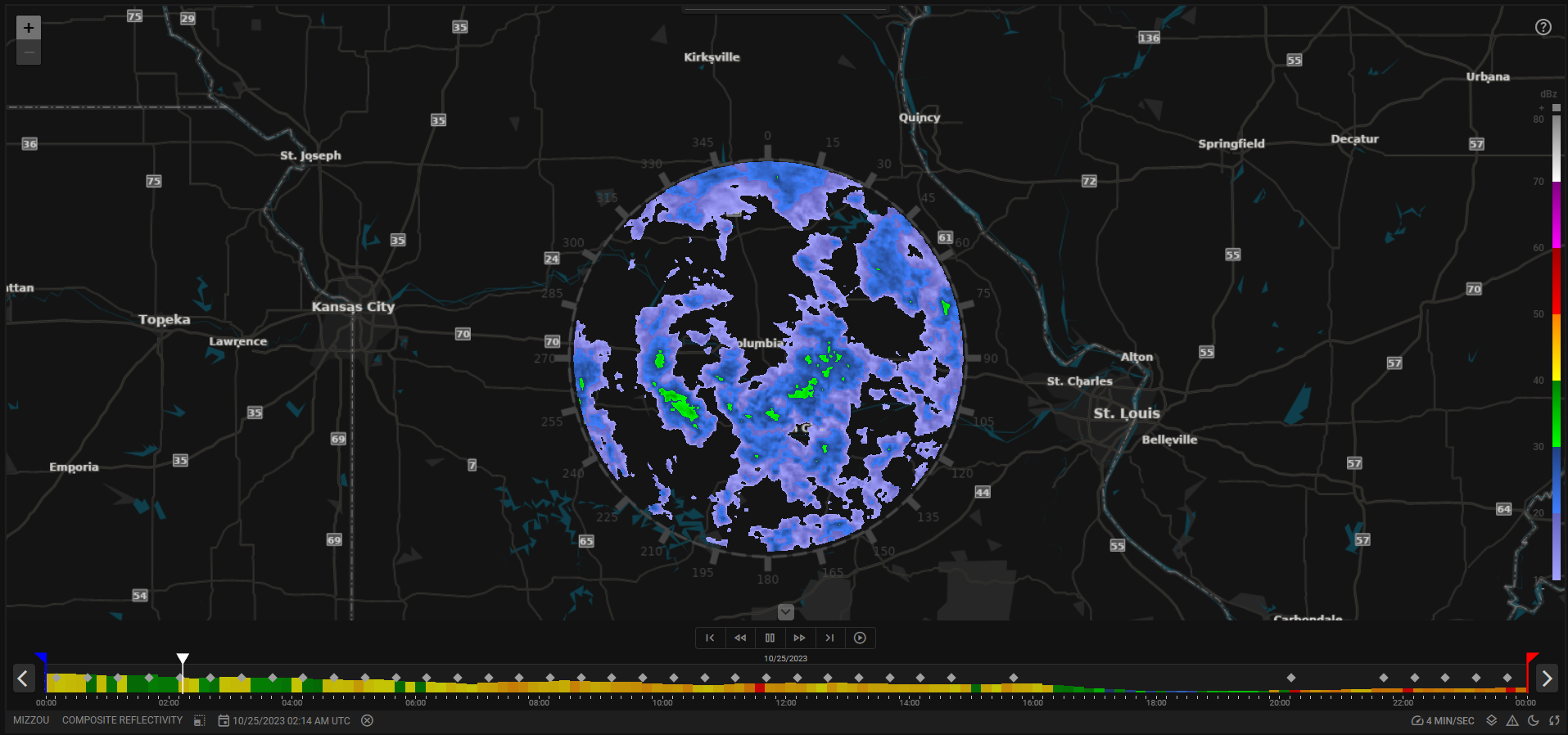
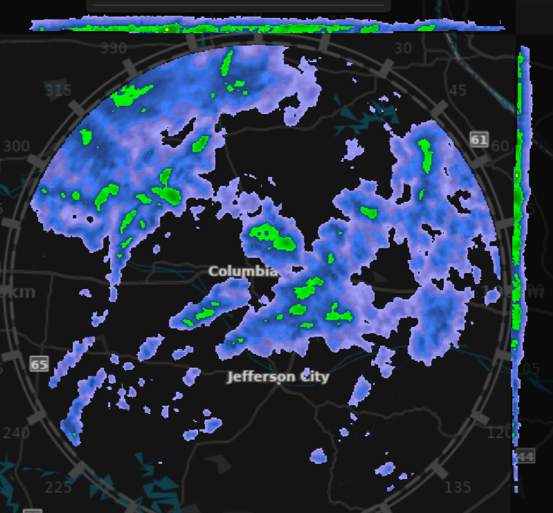
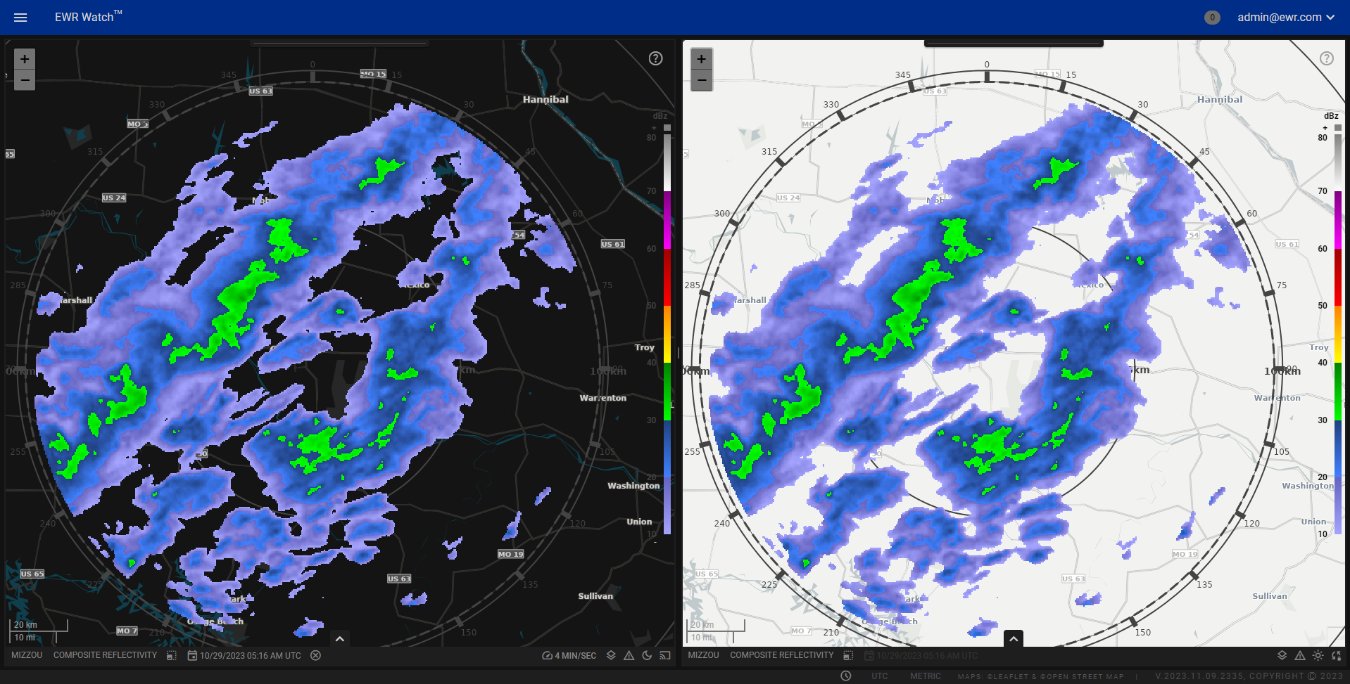
A central feature of this panel is the Map Area, providing an immersive visualization of radar products. Explore weather patterns, monitor storm movements, and analyze atmospheric conditions with precision. This display offers a detailed and visually engaging representation, catering to meteorologists, researchers, and weather enthusiasts alike.
-
Custom Map Data
Our product panel allows users to upload and visualize custom map data via the Layers Page for each radar, giving them the ability to explore specific geographic information tailored to their needs. This can include custom shape files, raster satellite images and more. Once imported you can style the data using our Layer Style Page. -
Radar Products
Integrated within the map area is a dynamic display of radar products. Users can view live or historic radar data overlaid on the map, providing essential weather information. -
Radar Coverage Ring
A radar coverage ring encircled inside the map displays the radar products boundaries, marked at 15-degree intervals. This feature aids users in understanding the directional coverage of the radar products, allowing for precise analysis and interpretation of weather patterns. -
Interactive Zoom Controls
Effortlessly navigate the map with our intuitive zoom buttons. Users can zoom in for detailed exploration or zoom out for a broader perspective, providing a seamless and responsive experience. You can also optionally zoom in and out using the scroll wheel on your mouse. Panning is achieved by left click and hold on the map while dragging the mouse in the intended direction.Panning and zooming is currently restricted to an ample geographic region around the currently selected radar.
-
Dynamic Legend
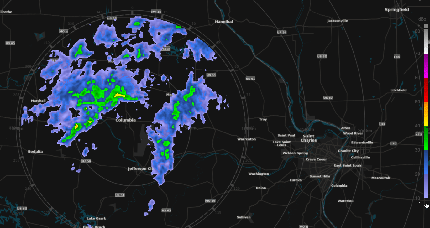
A color legend is provided, corresponding to the radar product data. When hovering over radar data, the color legend displays the specific value in a small box offering precise data interpretation. -
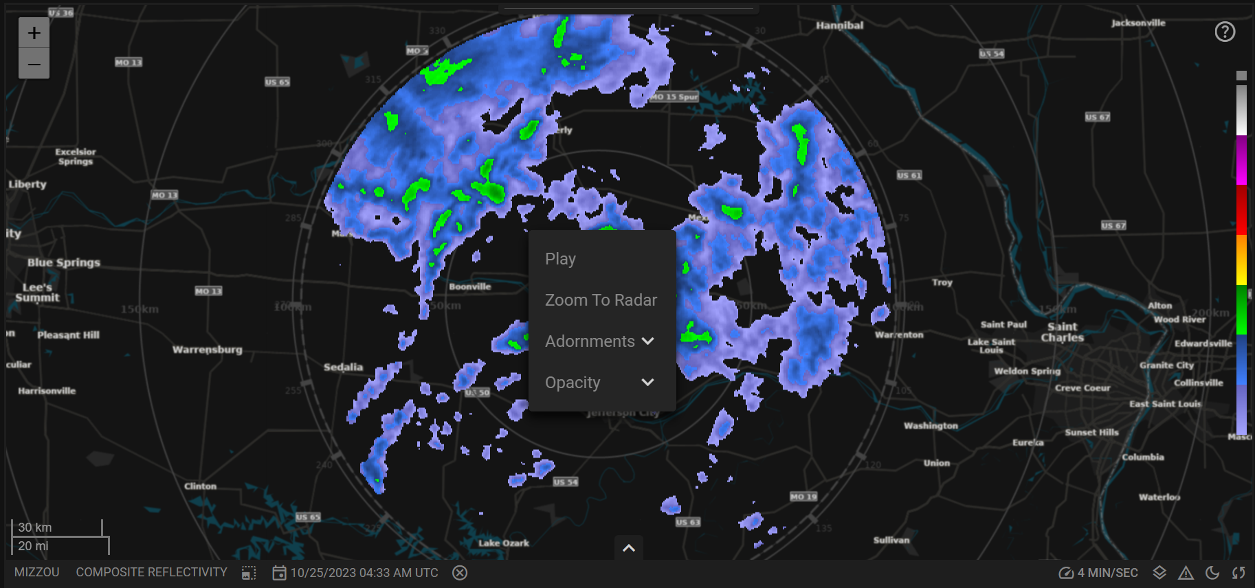
Right-Click Menu Options
Upon right-clicking the map area, users gain access to a contextual menu packed with powerful tools, enhancing their overall experience and enabling precise control over the displayed data. The right-click menu serves as a gateway to several essential features, ensuring users can effortlessly interact with the map and radar products to customize according to their specific needs.
- Play
Play the radar product to visualize its movement and changes over time. - Zoom to Radar
Instantly re-center the map to the radar coverage ring for focused analysis. - Adornments Menu
Access a menu to toggle various map adornments, including color legend, range rings, coverage ring, and scale bar. - Opacity Menu
Adjust the opacity of radar products in increments of 20%, ranging from 100% to 20%, allowing users to control the visibility of overlaid radar products.
Scrubber Bar
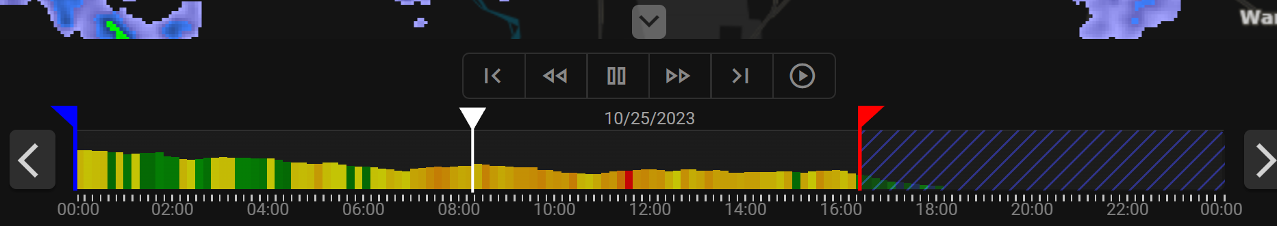
Below the Map Area, the Scrubber Bar hosts a comprehensive Playback Control Group, offering six playback buttons and one button to hide the scrubber bar:
- First Frame: Jump to the initial product in the time window.
- Previous Frame: Move to the previous product in the time window.
- Play/Pause: Start or pause the animation.
- Next Frame: Move to the next product in the time window.
- Last Frame: Jump to the final product in the time window.
- Live: Switch to live view.
Live view will automatically change the time frame, of the scrubber bar, to the current day and move the blue time range marker to be two hours behind the current time. The system will then start playing products from the two hours ago until the current time. This create a continuous loop of the last two hours of time. As time progresses the scrubber bar will shift forward in time to ensure a two hour current window. - Show/Hide: Hide the scrubber bar to show more of the map area.
- Move 8 Hours: These buttons move the time windows of the scrubber bar behind or ahead 8 hours.
- Playback Head: This represents the current location in time for the image displayed on the map. Users may drag this head to change the current viewed time.
- Start and End Posts:
The Scrubber Bar features movable Start and End Posts for dynamic playback, allowing users to focus on specific time intervals. You can drag these posts to specify constrained time windows.
Panel Settings

Located beneath the Scrubber Bar, the Panel Control Bar offers a range of controls for customization:
-
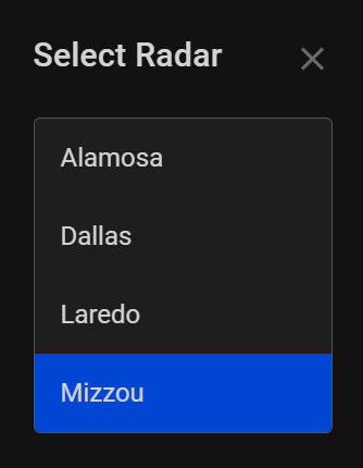
Radar Select: Choose specific radars.
-
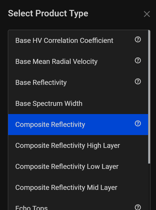
Select Product: Select from various radar products.
-
Show Panels: Display the current product in panel view if applicable.
-
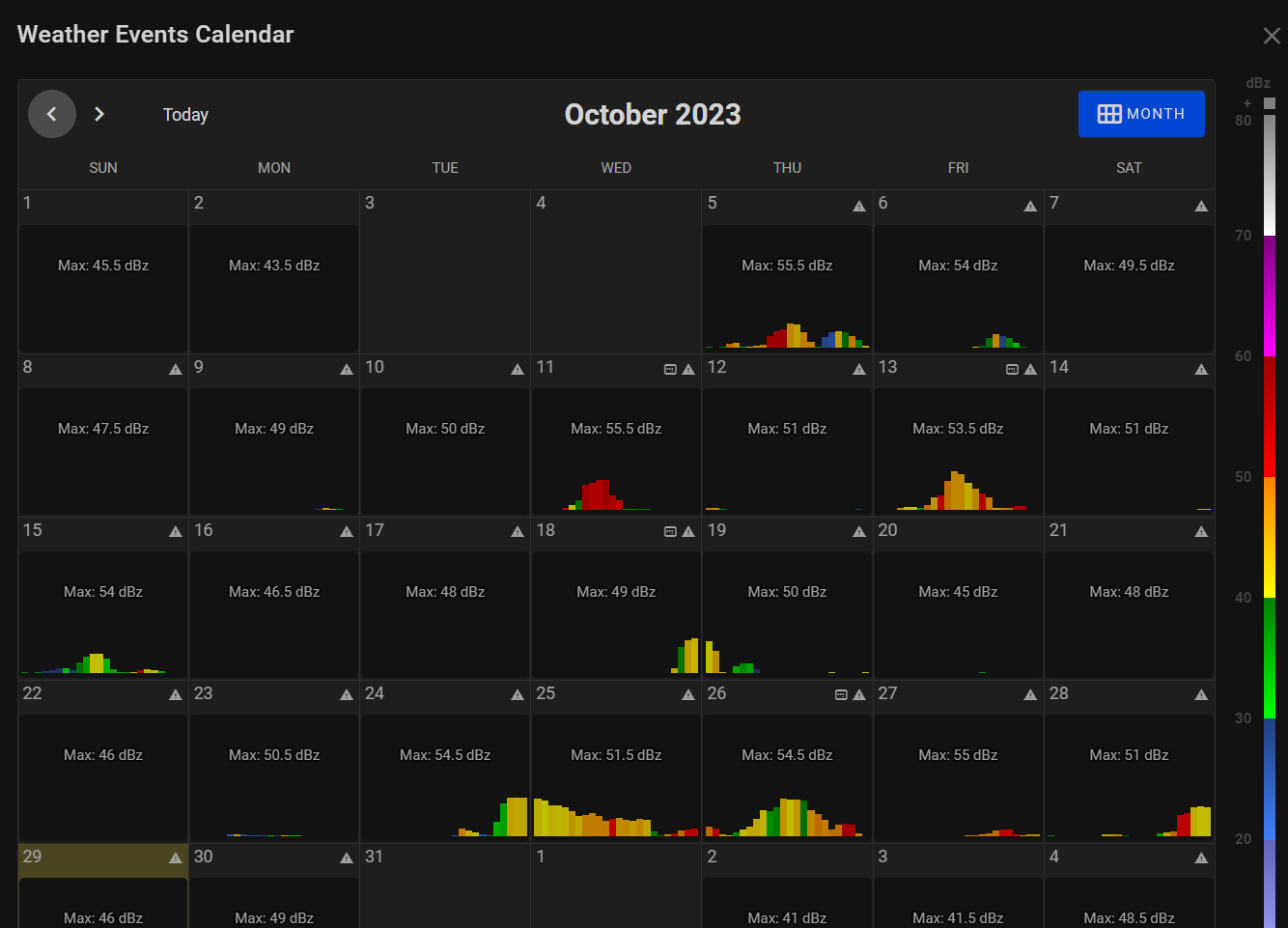
Open Calendar: Access historical data using the Weather Calendar.
-
Clear Map: Clear the current time frame of products from the scrubber bar and map.
-
Playback Speed: Adjust the speed of the radar data animations.
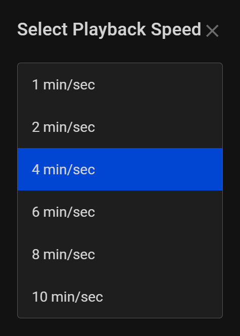
The speeds are displayed in minutes/seconds which mean that x minutes of products are displayed in 1 seconds in the viewer. As an example '1 min/sec' would mean that the time would tick one minute, while viewing products, for every second in the viewer. Put another way if a radar reported a specific product every five minutes then it would take five seconds in to display each product, which is quite slow. On the other hand the '10 min/sec' using the same product would display a product every half second.
-
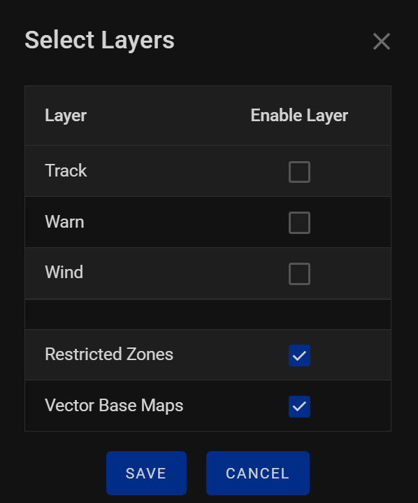
Layers: Toggle between different layers.
-
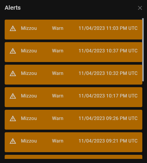
Warns/Tracks: View weather warnings and storm tracks.
-
Light/Dark Mode: Switch between light and dark themes.
-
Sync Maps: Synchronize multiple maps for comparative analysis.
-
Full Screen: Toggle full screen and minimized windows.